SATELLITE BATHYMETRY
Modern imaging technology
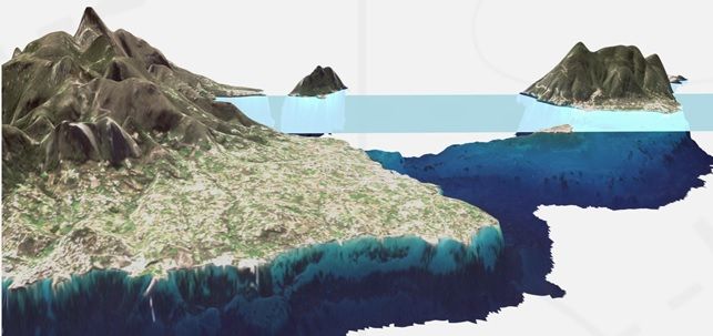
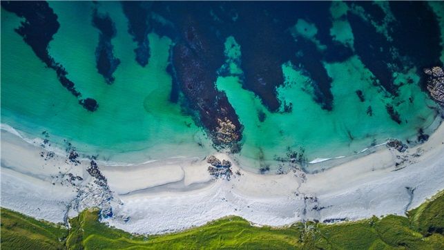
We offer satellite bathymetry, using modern satellite systems to accurately map water areas. Thanks to our cooperation with the industry leader, EOMAP, we provide precise data for hydrographers, surveyors and engineers involved in the study of marine and inland waters.
Shallow water measurements
Integrated EOMAP shallow water solution that provides valuable information for engineers investigating shallow shores of marine or inland waters. This type of data is extremely useful for designing and monitoring coastal infrastructure.
Digital elevation models
Digital Elevation Models (DEM) support the design process and monitoring of coastal defenses. EOMAP data provides a gridded, consistent XYZ dataset, supporting geodetic and hydrographic databases.
Shoreline monitoring
The EOMAP service provides quantitative information on coastal erosion for a coastline. It is possible to analyze the current coastline and access historical information from several decades ago.
The EOMAP service offered by ESCORT Sp. z o.o. provides an assessment of the current coastline, as well as monitoring changes to assess the degree of accretion or erosion. The analyses are based on various satellite sources, such as the Copernicus Sentinel-2 satellites or DigitalGlobe's WorldView.
Key Information for Hydrographers and Land Surveyors
Vertical reference system of satellite-derived bathymetric data
Thanks to the vertical datum of the bathymetric data from the satellites, all data is referenced to the lowest astronomical tide. Other datums, such as mean sea level, are also available on request.
Bathymetric data in ENC format
We provide bathymetric data in S-57 format, ideal for further processing in GIS and hydrographic systems.
Maximum Depth
The maximum water depth for which the satellite bathymetry method can be used is closely related to the depth of sunlight penetration. This depth varies depending on the season and location, so there is no single universal depth for all areas.
For various water bodies, bathymetric mapping depths using satellite technology are as follows:
- Baltic Sea: 2 to 15 m
- Red Sea: 20 to 30 m
- Persian Gulf: 5 to 15 m (depending on location)
- Mediterranean Sea: 20 to 30 m
- Caribbean Sea: 20 to 30 m
- West Coast of the United States: 5 to 15 m
- Pacific region: 20 to 30 m
Satellite bathymetry enables precise mapping of water depth in these water bodies, which is particularly important for hydrographic studies and planning of infrastructure projects.
It is possible to estimate the feasibility of satellite bathymetry for a specific area.
Integration with GIS systems
EOMAP data is OGC compliant, making it easy to open, visualize, and analyze data in any GIS system. It is also compatible with hydrographic software.
Combining EOMAP data with existing models
EOMAP data is fully compliant with OGC international standards, which ensures easy integration with GIS systems and other applications. It also contains metadata compliant with ISO 19139, which guarantees high quality and compatibility with other geoinformation data.
This allows EOMAP data to be easily opened, visualized, and analyzed using scripts or integrated with existing hydrodynamic, geodetic, and other models. This enables efficient processing of bathymetric data and their use in advanced geospatial analyses.


Data format
We offer various data formats such as:
- ASCII XYZQ (point cloud)
- GeoTIFF (georeferenced raster files)
- KMZ for Google Earth
- Shapefile
All data is in accordance with ISO 19139. ENC and CAD formats are also available on request.
Depth measurement uncertainty
Depth measurement uncertainty is supplied with the data and is expressed as LE90 confidence limits, meaning that 90% of the data falls within the specified depth uncertainty. These uncertainties are a combination of internal model uncertainties (such as sensor sensitivity) and external uncertainties (uncertainties in tides) and are compared to field data or, where available, to charted data. Under ideal conditions and with field data available, SDB EOMAP data is accurate to within 0.5m LE90. Without field data, the uncertainty increases and is typically between 0.5m and 1.0m LE90, with a depth-dependent factor of 10 to 15% of water depth.
Position uncertainly
Geolocation uncertainty depends on the spatial resolution of the bathymetric grid and therefore on the source of the satellite imagery. They are expressed as CE90 confidence limits, meaning that 90% of the data falls within the specified horizontal uncertainty. For 2 m bathymetric grids the horizontal uncertainty is 5 m CE90, for 10 m grids it is 10 m CE90 or better, and for 30 m grids it is 30 m CE90.

