POMIARY ROZMYCIA DNA
Sonar Documentation: Assessment of Seabed Erosion and Condition of Underwater Structural Elements
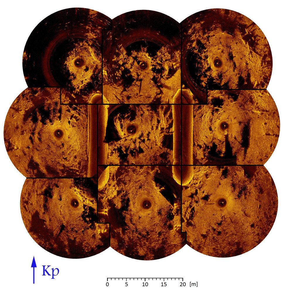
The documentation prepared based on sonar images is used to assess the current technical condition and, in the future, to evaluate the speed of changes caused by the erosive effects of water. Thanks to advanced sonar technology, it is possible to obtain a detailed image of the seabed and underwater structural elements, facilitating decision-making regarding the safety of hydrotechnical structures.
Advantages of Sonar Images in Seabed Condition Assessment
Sonar images offer several key benefits when evaluating the condition of the seabed and underwater structures: 1. **High Resolution and Precision**: Advanced sonar systems, such as MS1000, provide detailed and accurate images of the seabed and underwater objects, allowing for precise assessment of potential issues. 2. **Non-invasive Method**: Sonar-based inspections do not require physical contact with the seabed, minimizing disturbance to the environment and infrastructure, while providing detailed data without the need for diving. 3. **Real-time Monitoring**: Sonar technology enables real-time monitoring of changes in the seabed’s condition, making it easier to track erosion, sediment movement, and structural degradation. 4. **Efficient Coverage of Large Areas**: Sonar systems allow for the rapid scanning of large areas, providing comprehensive data on the seabed and submerged structures, which is crucial for large-scale inspections of port areas or waterway infrastructure. 5. **Data for Preventive Maintenance**: The images and data gathered by sonar systems help identify potential risks early, allowing for proactive maintenance and reducing the likelihood of costly repairs or accidents. 6. **Historical Comparisons**: By storing sonar images over time, it’s possible to create a historical record of the seabed condition and compare changes, which is crucial for long-term monitoring and decision-making regarding infrastructure maintenance and safety. These advantages make sonar images an invaluable tool for assessing and monitoring the technical condition of seabeds and underwater construction elements.
Sonar Images – A Tool for Underwater Diagnostics
Sonar images serve as a powerful tool for underwater diagnostics, offering a range of benefits when assessing submerged structures, seabeds, and other aquatic environments. The key advantages of using sonar imaging for diagnostics include:
- Survey of seabed cleanliness over large areas.
- Detection of structural defects and irregularities.
- Identification of hazardous areas that may pose a threat to divers.
Thanks to such sonar maps, divers can more easily locate suspicious areas and prepare for more detailed investigations in challenging underwater conditions.
Monitoring of Seabed Erosion
As part of the seabed erosion monitoring activities, we offer a range of services:
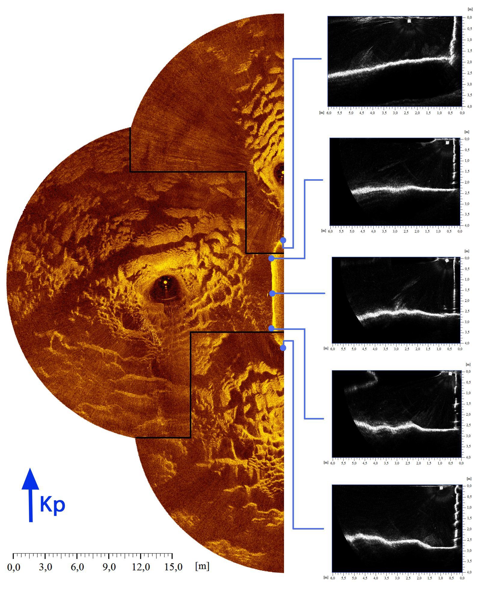
- - Development of erosion maps in the vicinity of bridge supports,
- Seabed erosion monitoring,
- Bathymetric cross-sections of rivers and water reservoirs
- Forecasting future seabed erosion
- Safety analysis of bridge operations, taking into account changes in seabed structure and the condition of bridge supports
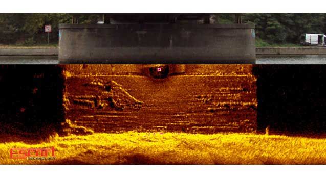
- Underwater imaging of bridge support walls,
- Geophysical surveys of the layering system beneath the riverbed prior to planned drilling activities
- Verification of the quality of the executed stone armoring.
Geophysical Measurements
Our offer also includes detailed geophysical surveys regarding the soil layer structure beneath the riverbed, as well as the assessment of the foundation depth of hydrotechnical structures. These measurements enable a better understanding of the geotechnical conditions in the area of bridges and other hydrotechnical engineering structures.
Remote Monitoring of Scour Around Bridge Piers – Ensuring Bridge Safety
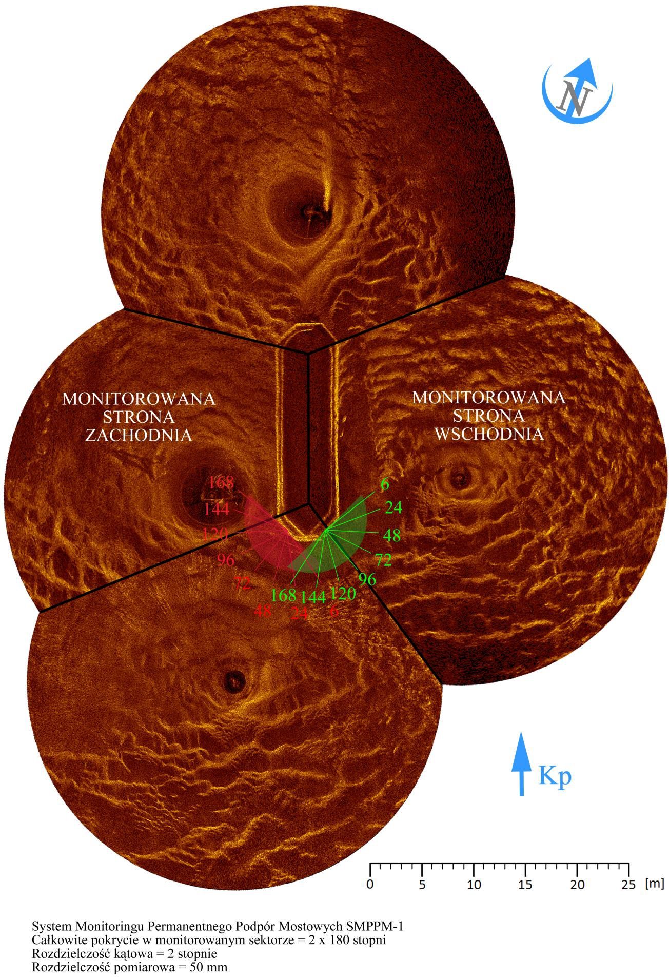
Remote Monitoring of Scour is a modern system for continuous supervision of the riverbed elevation in the vicinity of bridge piers. It enables the acquisition of quantitative data and visual data in real-time, which allows for a rapid response to potential threats related to scour around bridge piers, especially during periods of high water levels or floods.
Benefits of Remote Scour Monitoring
By utilizing advanced riverbed monitoring software, the system detects any changes in the riverbed structure around the piers, enabling forecasting and rapid response to erosion-related hazards. The software displays current flood stage conditions, allowing for the early detection of situations that could threaten the stability of the bridge due to scour.
Scour Monitoring – A Key Tool in Bridge Safety Management
Remote monitoring is a key element in assessing the technical condition of bridges, especially in the context of changing hydrological conditions. The ability to continuously monitor and detect scour early allows for the prevention of damage to bridge supports and minimizes the risk of structural failures.
Advantages of Remote Monitoring of Scour
- Real-time Monitoring: The continuous acquisition of data on the riverbed condition allows for faster decision-making in case of hazards.
- Bridge Safety: Rapid response to changes in the riverbed structure around bridge supports prevents their damage.
- Flood Hazard Detection: Monitoring the flood stage of rivers and water reservoirs allows for forecasting potential erosion-related hazards during periods of high water levels.
- Risk Reduction: Remote monitoring enables the identification of hazards related to scour, which can prevent serious damage to bridges and ensure the long-term structural stability.
Utilizing Modern Solutions – Scour Monitoring
Advanced software provides comprehensive visual and quantitative data regarding the riverbed condition, which supports bridge safety management and the planning of preventive actions. This system is indispensable in regions prone to floods and changing hydrological conditions, ensuring long-term protection of bridge infrastructure.


